
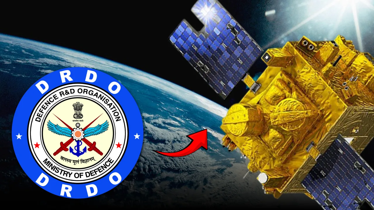
DRDO has publicly identified the geolocation of terrestrial radio emitters from low-Earth-orbit satellites as a defence research priority, including formation-flying concepts similar to HawkEye 360. The evidence supports active development of enabling technology, but not yet a publicly confirmed Indian constellation with a declared satellite count, deployment schedule or 15-minute revisit time.
India is taking a concrete step towards developing an indigenous capability to detect and locate radio-frequency emitters from space.
The Defence Research and Development Organisation's Defence Electronics Research Laboratory (DLRL) has defined a research problem specifically for the "Geolocation of Terrestrial Radio Emitters from RF Payloads on LEO Satellites." DRDO's website also lists geolocation techniques for electronic intelligence, or ELINT, among its space-technology priorities. Most recently, DRDO's message board on September 25, 2026 listed a fresh call for proposals covering research problems for its Industry Academia Centres of Excellence.
That is significant evidence of an active technology-development effort. It is not, however, the same as confirmation that India has approved or begun deploying a complete HawkEye 360-style satellite constellation.
The distinction matters because several of the specifications now associated with the reported Indian system, particularly a revisit time of around 15 minutes, come from DRDO's description of the foreign capability it is studying rather than from a disclosed Indian operational requirement.
What DRDO Has Actually Disclosed
The DLRL research problem is unusually specific about the technology India wants to master.
It describes formation-flying satellites in low Earth orbit and identifies Automatic Identification System (AIS), Automatic Dependent Surveillance-Broadcast (ADS-B), military radio and radar transmissions as relevant targets. It also discusses three-satellite triangular and four-satellite rectangular formations, and the use of Time Difference of Arrival (TDOA) and Frequency Difference of Arrival (FDOA) techniques to geolocate an emitter.
In simple terms, multiple satellites receive the same transmission from slightly different positions. Differences in when the signal reaches each satellite, combined with differences in observed frequency caused by relative motion, can be processed to estimate where the transmitter is located.
That is fundamentally different from simply detecting that radio-frequency energy exists. The objective is to turn intercepted emissions into coordinates.
DLRL says the work requires precise time and frequency synchronisation between satellites, accurate knowledge of their orbital positions, collection of digitised in-phase and quadrature signal data, and subsequent processing through a ground station. The requested deliverables include satellite geometry, trajectories, data-link throughput, RF payload capabilities, signal-processing algorithms and ground-station computation.
Crucially, DRDO describes the algorithms as an "enabling technology for future Projects." Publicly available material does not establish that a complete operational constellation has already been sanctioned, nor does it disclose its budget, satellite count, orbital architecture, payload specifications or launch schedule.
The 15-Minute Figure Needs an Important Qualification
DRDO's research document discusses a future surveillance revisit time of roughly 15 minutes, but the passage is describing the HawkEye-type architecture being used as the reference case.
The document says that with multiple constellations in multiple orbits, the foreign system's revisit time over an area of interest is projected to approach 15 minutes. It does not state that an Indian constellation has already been designed or approved to meet the same figure.
That distinction substantially changes how the development should be reported.
India is researching the technologies required to build a formation-flying space-based RF geolocation system. A 15-minute Indian revisit capability is a plausible design ambition for a sufficiently large constellation, but it is not a publicly established performance specification at this stage.
The same caution applies to descriptions of a future Indian system as a direct indigenous equivalent of HawkEye 360. The comparison is useful for explaining the mission, but there is not yet enough public information to establish equivalence in frequency coverage, geolocation accuracy, latency, constellation size or analytical capability.
India Is Not Starting From Zero
Space-based electronic intelligence itself is not new to India.
ISRO launched EMISAT in April 2019 into a 748-kilometre sun-synchronous polar orbit. The 436-kg spacecraft is officially described by ISRO as being intended for electromagnetic-spectrum measurement. Public reporting and DRDO material have associated it with the Kautilya space-borne ELINT payload, developed to intercept and locate radar transmissions.
The emerging DLRL work points towards a different architectural approach. Instead of relying only on an individual satellite's sensing and direction-finding capability, coordinated LEO satellites can exploit their spatial separation to calculate an emitter's position.
This is why formation flying matters.
HawkEye 360 currently operates more than 30 satellites at roughly 500 km altitude, with spacecraft operating in clusters of three. The company says its system uses cluster-based TDOA and FDOA processing to geolocate RF emitters.
For India, mastering the same underlying class of technology would mean moving from possessing a space-based ELINT asset towards potentially building a distributed RF intelligence architecture.
India Is Already Buying Access to HawkEye 360 Data
The timing of DRDO's work is particularly important because India is simultaneously acquiring access to foreign commercial RF intelligence.
In April 2025, the U.S. State Department approved a possible $131 million Foreign Military Sale to India for Indo-Pacific Maritime Domain Awareness. The package included SeaVision software, training, analytical support and related services, with HawkEye 360 identified as the principal contractor. The U.S. notification was an approval for a possible sale, not confirmation at that point of the final contract value.
By July 2026, HawkEye 360 announced that it had received a multi-year contract to provide space-based RF data and analytics to the Indian Navy and regional partners under the wider programme. The company said the service would include daily RF signal collection and geolocation, analytical support and training.
This is an important distinction in the sovereignty debate. India is not buying HawkEye 360's constellation. It is obtaining access to data, analytics and associated services generated by a foreign-owned space and ground infrastructure.
That can address an immediate operational requirement without waiting years for an indigenous constellation. But it also explains why an Indian capability has strategic value.
A sovereign system would allow India to determine collection priorities, geographic areas of interest, frequencies, revisit requirements, data-retention policies and analytical workflows according to its own military and intelligence requirements. It would also reduce the risk that access to an important intelligence layer depends indefinitely on a foreign commercial provider and another country's regulatory environment.
The strongest strategy, therefore, is not necessarily foreign data or indigenous capability. In the near term, the two can complement each other: commercial RF intelligence provides operational experience while domestic research builds the technologies required for sovereign collection.
What Such Satellites Could Actually Detect
The attraction of space-based RF surveillance is that many military and civilian platforms must emit electromagnetic energy to perform their missions.
Air-defence radars illuminate airspace. Military units use radios and satellite communications. Ships operate navigation radars and communications equipment. Civil aircraft normally broadcast ADS-B signals, while vessels commonly transmit AIS positions.
A satellite constellation capable of detecting, characterising and geolocating those emissions can therefore build a map of activity without requiring an imaging satellite to identify every object visually.
For military intelligence, one of the most important applications would be electronic order of battle. Repeated detections could help analysts establish where radars are located, when they become active, whether mobile systems have moved, and how patterns of electromagnetic activity change during exercises or crises. Commercial HawkEye services already market space-based monitoring of fixed and mobile air-defence radars for this purpose.
There is also a major maritime application. A vessel that disables AIS does not necessarily become electromagnetically invisible. If it continues operating a navigation radar or another detectable transmitter, space-based RF sensors may still reveal activity inconsistent with the publicly reported maritime picture. HawkEye 360, for example, explicitly uses radar emissions to identify vessels operating without AIS.
But "dark ship detection" needs qualification. An RF constellation cannot detect a completely radio-silent vessel merely because its AIS has been switched off. There must still be a detectable emission, or the RF data must be fused with another sensor such as synthetic-aperture radar, electro-optical imagery or airborne surveillance.
The same limitation applies to aircraft. Switching off ADS-B removes one source of information, but RF geolocation would require some other detectable emission. Passive targets cannot simply be located from space by an RF receiver when they are transmitting nothing.
From the Indian Ocean to the Land Borders
For India, the Indian Ocean Region is an obvious operational environment for this technology.
The area is too large for persistent coverage by patrol aircraft and surface vessels alone. Space-based RF collection could add another layer for monitoring naval radar activity, commercial shipping anomalies, smuggling networks, illegal fishing and suspicious maritime behaviour, while cueing P-8I aircraft, ships, drones, coastal sensors or imaging satellites towards areas requiring closer examination.
The U.S.-approved maritime-domain-awareness programme and HawkEye 360's subsequent Indian Navy contract already demonstrate that New Delhi sees operational value in precisely this type of data.
Over land, the military application could be even more sensitive. Recurring detection of radar and communications emitters could contribute to monitoring air-defence deployments, electronic-warfare activity and communications patterns around contested borders.
That could make space-based RF intelligence relevant to areas around the Line of Actual Control and other sensitive theatres, particularly when combined with electro-optical imagery, synthetic-aperture radar, airborne electronic intelligence and ground-based sensors.
RF intelligence should therefore be understood as one layer in a multi-sensor architecture, not as a replacement for conventional surveillance.
The Hard Part Is Not Merely Launching Satellites
Building the spacecraft is only one part of the challenge.
A useful operational system requires sensitive wideband RF payloads, highly accurate timing, precise orbit determination, synchronisation between satellites, stable formation geometry, high-capacity downlinks, secure ground infrastructure and algorithms capable of separating useful emitters from an extremely crowded electromagnetic environment.
Accuracy also depends on factors such as signal strength, waveform characteristics, frequency, satellite geometry, terrain, interference and the number of spacecraft observing the emitter.
Then comes the intelligence problem. Detecting an emitter is useful; determining what it is, whether it has moved, how it relates to other emitters and whether its activity indicates a change in military posture is considerably more valuable.
That requires libraries of known signals, pattern-of-life analysis, data fusion and integration with other intelligence sources. DRDO's wider technology-foresight programme already lists AI and machine-learning-based multi-sensor data fusion for space-based surveillance alongside ELINT geolocation, suggesting that the challenge is being viewed as more than a satellite-payload problem.
Sovereignty Is the Strategic Prize
India's immediate access to HawkEye 360 data can strengthen maritime awareness. An indigenous system would serve a different strategic objective.
Sovereign RF collection would give India control over what is collected, when it is collected and how quickly it is delivered to military users. It could also allow classified Indian signal libraries and intelligence sources to be integrated without exposing the complete analytical chain to an external provider.
There is a broader industrial consequence as well. A domestic constellation would require Indian capability in RF payloads, space-qualified electronics, precision timing, formation flying, satellite buses, ground stations, secure communications, signal processing and military data fusion. Those technologies would have applications well beyond a single surveillance programme.
The evidence available today does not support saying that DRDO has already committed to an operational HawkEye 360 equivalent with a 15-minute revisit rate. It supports something more precise: DLRL is actively pursuing the algorithms and system design needed to geolocate terrestrial RF emitters from coordinated LEO satellites, and DRDO continues to identify ELINT geolocation as a future space technology.
That is the stage to watch.
The decisive next development would be evidence that the research effort has moved into an approved flight programme: a defined constellation architecture, sanctioned funding, RF payload development, identified satellite and launch partners, prototype missions or an operational requirement from the armed forces.
If that happens, India would be moving beyond purchasing access to space-based RF intelligence and towards controlling the collection architecture itself. For a military increasingly dependent on information from the electromagnetic spectrum, that distinction is strategically significant.
Sources
DRDO, Research Problems for DIA-CoEs - establishes DLRL's research problem on geolocating terrestrial RF emitters from LEO satellites, formation flying, TDOA/FDOA, target signal classes and ground processing. DRDO research document
DRDO Message Board - establishes the September 25, 2026 call for proposals covering Research Problems for DIA-CoEs. DRDO Message Board
DRDO Space Technologies - identifies ELINT geolocation and multi-sensor data fusion among DRDO's space-technology development priorities. DRDO Space Technologies
ISRO, EMISAT - establishes EMISAT's 2019 launch, 436-kg mass, 748-km sun-synchronous orbit and electromagnetic-spectrum measurement mission. ISRO EMISAT mission page
U.S. Defense Security Cooperation Agency - establishes the April 2025 approval of a possible $131 million Indo-Pacific Maritime Domain Awareness sale to India and HawkEye 360's role as principal contractor. DSCA India Indo-Pacific Maritime Domain Awareness notification
HawkEye 360 - establishes the July 2026 multi-year contract to provide the Indian Navy and regional partners with space-based RF collection, geolocation, analytics and training. HawkEye 360 Indian Ocean Region contract announcement
HawkEye 360 - explains its formation architecture and use of TDOA/FDOA for RF-emitter geolocation, providing the relevant operational comparison for the technology DRDO is studying. HawkEye 360 technology overview
HawkEye 360 - establishes current applications of space-based RF intelligence to non-cooperative vessel detection and air-defence radar monitoring. HawkEye 360 maritime intelligence HawkEye 360 air-defence radar monitoring